Historical prototype · public-safe example · archive only
3BrainAI CRI Evidence Pack
Lausitz, Germany – post-mining transformation
Environmentally impacted former open-pit lignite mine undergoing large-scale flooding and redevelopment.
Hypothetical review question
Does the dated public optical evidence directionally support the hypothetical statement that flooding and post-mining transformation had substantially advanced within the observation area by May 2026?
Assessment summary
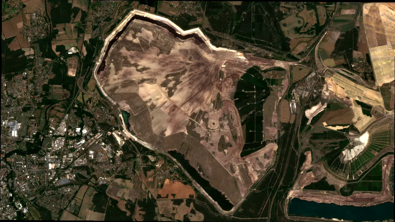
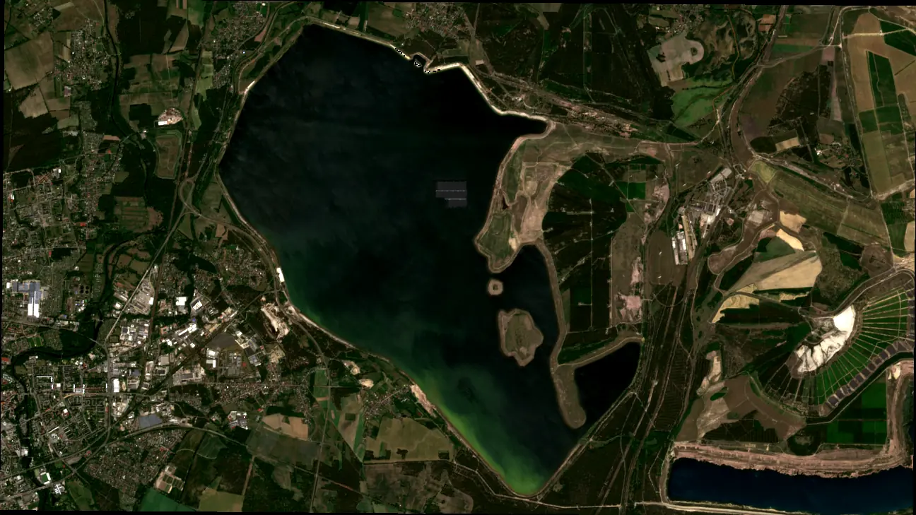
Dated optical observations show a substantial change from predominantly exposed surfaces in June 2019 to a large water body in May 2026. The hypothetical statement is directionally supported. Engineering completion, water quality and geotechnical condition cannot be determined from imagery alone.
Observed vs Declared
Declared – hypothetical
Flooding and post-mining transformation substantially advanced within the monitored area by May 2026.
Observed – dated public evidence
The May 2026 observation shows a large water body where the June 2019 baseline showed predominantly exposed surfaces.
Findings
- Substantial visible land and water-body change is present.
- The dated pair provides comparable surface context.
- The visible change supports the direction of the hypothetical statement, not overall completion.
Uncertainty and non-inference
Different acquisition dates and seasonal surface conditions affect direct comparison. The imagery does not establish cause, engineering completion, water quality, geotechnical safety or regulatory compliance.
Bounded conclusion
The observation pair supports only a limited directional review of the hypothetical statement. Documentary and engineering evidence remain necessary before any institution-specific conclusion.
Interpretation of WATCH: evidence sufficiency and the need for documentary review. It is not a negative project rating and does not indicate delay, breach or default.
Evidence input excerpt
Dated optical observation pair · true colour · public Copernicus inputs
Monitoring scope
The images show the full area of interest for geographic context. The target CRI workflow is intended to focus on selected zones, structures and project milestones at finer detail by combining appropriate observation and project data.