 3BrainAI
Who CRI is for
Banks, funds and property owners preparing a review or transaction decision about one property.
For banks, funds and property owners
Start with an earlier assessment of one property. CRI connects dated observations with the relevant records to help a specialist identify what needs checking before the next decision.
Source context
The aerial view is a real historical source, used for orientation.
Smíchov City, Prague · orthophoto retrieved from the ČÚZK service on 25 October 2026; exact acquisition day unverified. The retained case records a 2025 product reference. © ČÚZK / Zeměměřický úřad. CC BY 4.0.
The higher-resolution orthophoto uses the same coordinate grid as the retained SMI-W01 outline. Magenta marks this working area, derived from © OpenStreetMap contributors · ODbL 1.0; it is not an agreed project-phase or collateral boundary. The overview shows the full area and marks the detail crop with a dashed white rectangle. Cropping and WebP conversion are display changes; no image content was generated. The project phase and its milestone must be established from the relevant records.
An earlier assessment or project report gives the reviewer a starting point. CRI is being developed to connect that record with dated observations, identify the next review question and retain the reasoning.
Banks, funds and property owners preparing a review or transaction decision about one property.
A short, versioned Evidence Pack that keeps the question, sources, uncertainty and next responsible step together.
The public Evidence Pack and The Brief present prepared examples. The CRI demonstrator is in development. The functions available in a demonstration and the scope of any paid engagement are agreed separately. Specialist review remains part of the process.
Smíchov City · historical source context
The historical aerial view locates the development. A bank still needs a defined asset, project phase and dated records to assess a construction milestone.
The ČÚZK orthophoto supplies a historical view of Smíchov City. Its product-year reference is 2025; the exact acquisition day has not been verified.
Project phase to be confirmedWhich dated project plan and technical records define the structures, phase and acceptance criteria under review? The image alone cannot answer a question about drainage, paving or completion.
Documentary review neededSource data: the historical orthophoto supplies geographic orientation. Its source and display preparation are recorded above.
Scope: confirm the relevant asset and project phase with the institution.
Required records: identify the dated project plan, milestone definition and responsible technical assessment.
Review walkthrough: explore how these questions are worked through inside The Brief.
This public view presents source context and a question for review. It does not report a client engagement, a construction defect or a bank decision.
Satellite observations and project records
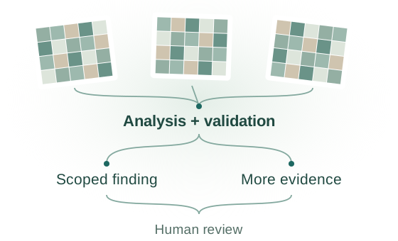
Satellite analysis
See how source selection, analysis and validation support a scoped human review.
Explore the analytical principleSchematic illustration · not measured CRI results.
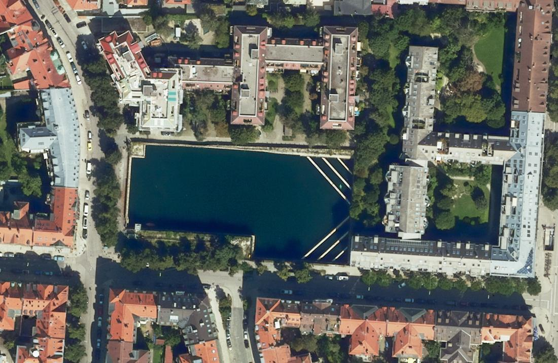
Case study · 24 Aug 2024
A documented restart. Two published dates. Which schedule applies?
Open the case studyBayerische Vermessungsverwaltung · Geodaten Bayern · CC BY 4.0 · Historical orthophoto; cropped.
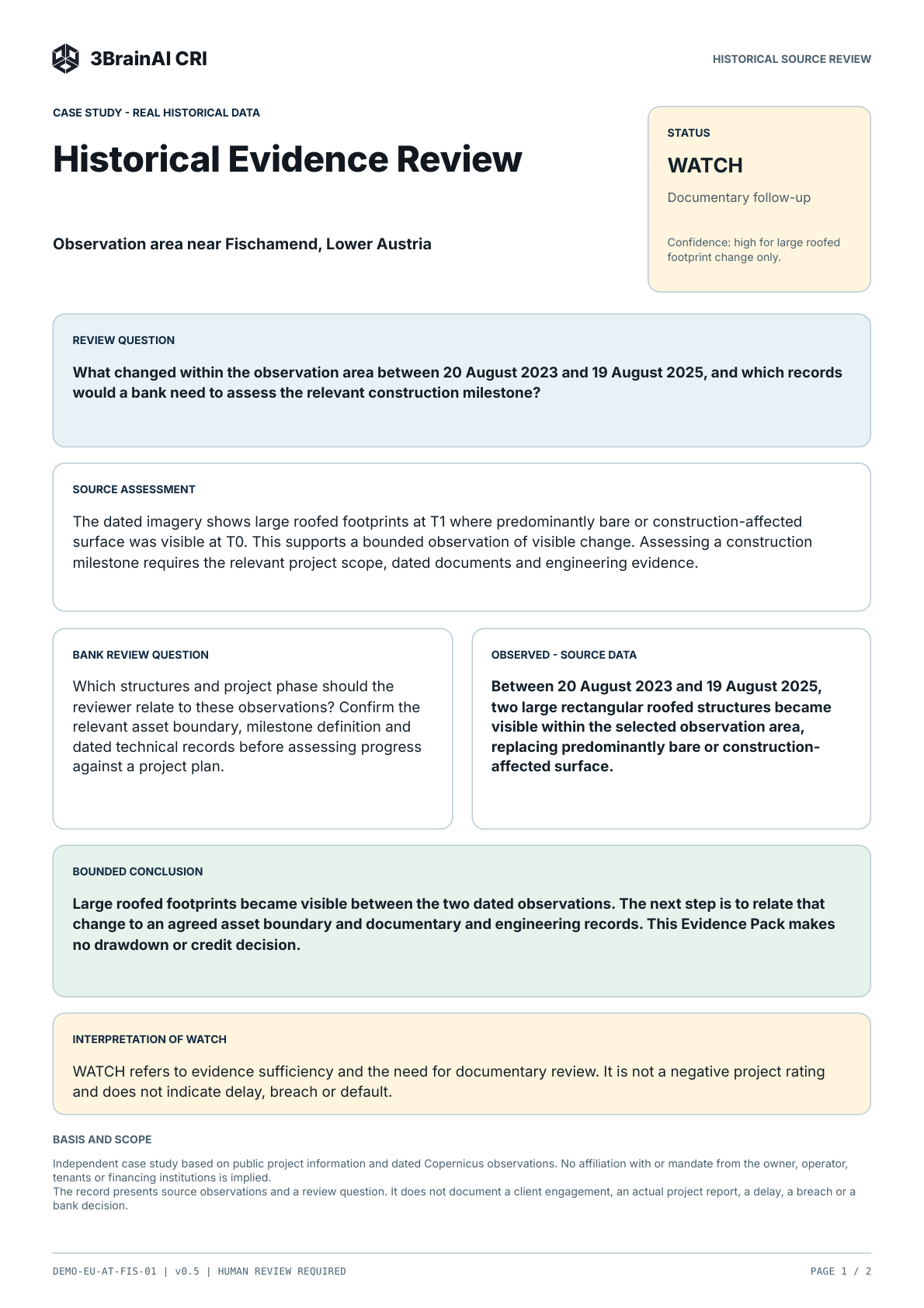
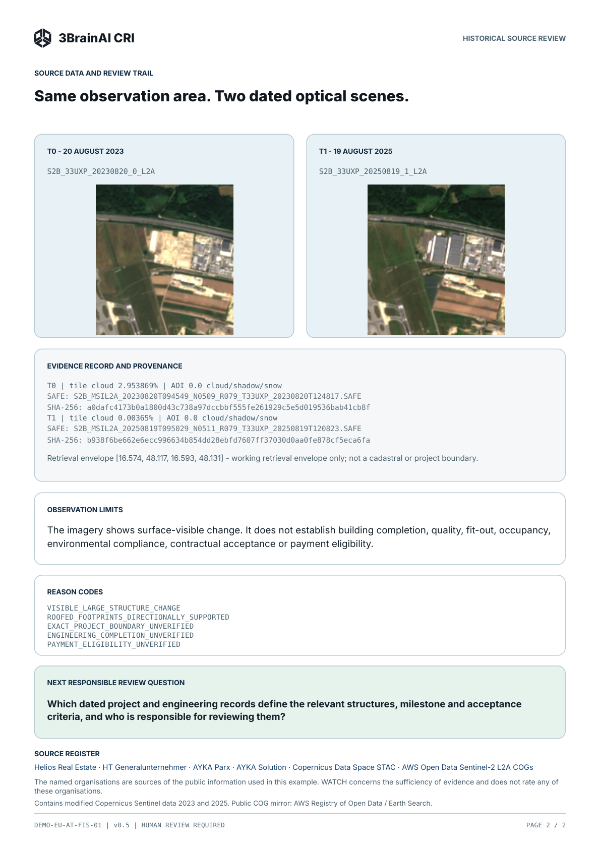
Public record · v0.5
Read the question, dated observations, limits and next review step in the actual document.
Inspect the Evidence Pack3BrainAI · Public illustrative record. No client engagement or bank decision is represented.
3BrainAI is developing Construction Risk Intelligence (CRI) to bring dated satellite observations together with authorised project records in a versioned Evidence Pack. For a construction lender or collateral reviewer, the useful question is what the available evidence supports, what remains uncertain and which document or expert response is needed next.
Satellite imagery can provide dated context about visible changes at a site. It cannot, by itself, establish engineering completion, contractual acceptance or eligibility for a loan drawdown.
KfW Development Bank’s RMMV Guidebook explores remote management, monitoring and verification in international financial cooperation. It provides context on project reporting, data sources and institutional responsibilities. This reference does not indicate a partnership or endorsement of CRI.
The review grammar
The four meanings remain distinct throughout the record.
What the institution’s project record or review question asks to be tested.
What the controlled source record supports within a stated observation boundary.
What remains partial, unverified or outside the permitted inference.
A reviewable record, not an autonomous credit or payment decision.
Two bank questions. One evidence discipline.
Examine a milestone declaration against the relevant baseline and technical records. Keep the scope of a previous acceptance distinct from the work now presented for review.
Focus follow-up between formal inspections. Ask whether a dated change is relevant to the monitored asset or one of its dependencies, and whether the next step needs documents, an explanation or a site visit.
Imagery supplies dated, surface-visible context. It does not establish property value, legal title, occupancy, hidden condition or protection against theft.
CRI combines specialist geospatial analysis and AI with source selection, alignment and suitability checks to prepare traceable evidence for these bank review questions.
Institutional fit
The workflow is designed to add a versioned evidence state between formal control points.
Existing controls – unchanged
CRI – designed to add between review points
Existing controls remain in place. CRI is designed to add a versioned evidence state between formal review points.
Source dates and reporting cadence depend on the agreed question; the Monday meeting is a narrative example.
The record you can inspect
Read the logic of a record: how its question, evidence, limits and human review fit together.
What is being reviewed — and within which scope?
The question, baseline and document authority.
The dated source and what it actually supports.
Connect the evidence to the question. State only what the available basis supports.
Identify missing evidence, uncertainty and what cannot be inferred.
A named reviewer can challenge or accept a claim within an explicit scope. The analytical proposal does not grant acceptance.
A schematic guide to reading a record. No case result or bank decision is represented.
Pending means the review is unfinished. Limited evidence means the basis is insufficient. Scoped acceptance records a human’s acceptance within a defined scope. Colour directs attention; it does not make a bank decision.
Target architecture
The source, analytical candidate and responsible human review have different roles.
Evidence suitability
Satellite observations, aerial context and project records each contribute a different part of the picture. The review question guides which sources belong together. CRI’s development focuses on keeping their dates, meaning and quality clear as the record moves towards human review.
Useful surface context depends on resolution, coverage, season and the actual review question. An aerial image alone cannot confirm a milestone.
Radar may add a different observation capability where it is suitable. Technical and project records remain necessary for questions an image cannot answer.
Insufficient observation cannot establish that nothing changed. The pack keeps the gap and the required follow-up visible.
Munich–Neufreimann · Open the dedicated case study →
Case study · Historical imagery and public project information
In Munich’s Neufreimann district, a former barracks site is becoming a neighbourhood with around 5,500 homes planned. On 25 August 2026, Münchner Wohnen announced the completion of 190 homes in building area WA12.
NEUFREIMANN · SOURCE REFERENCE
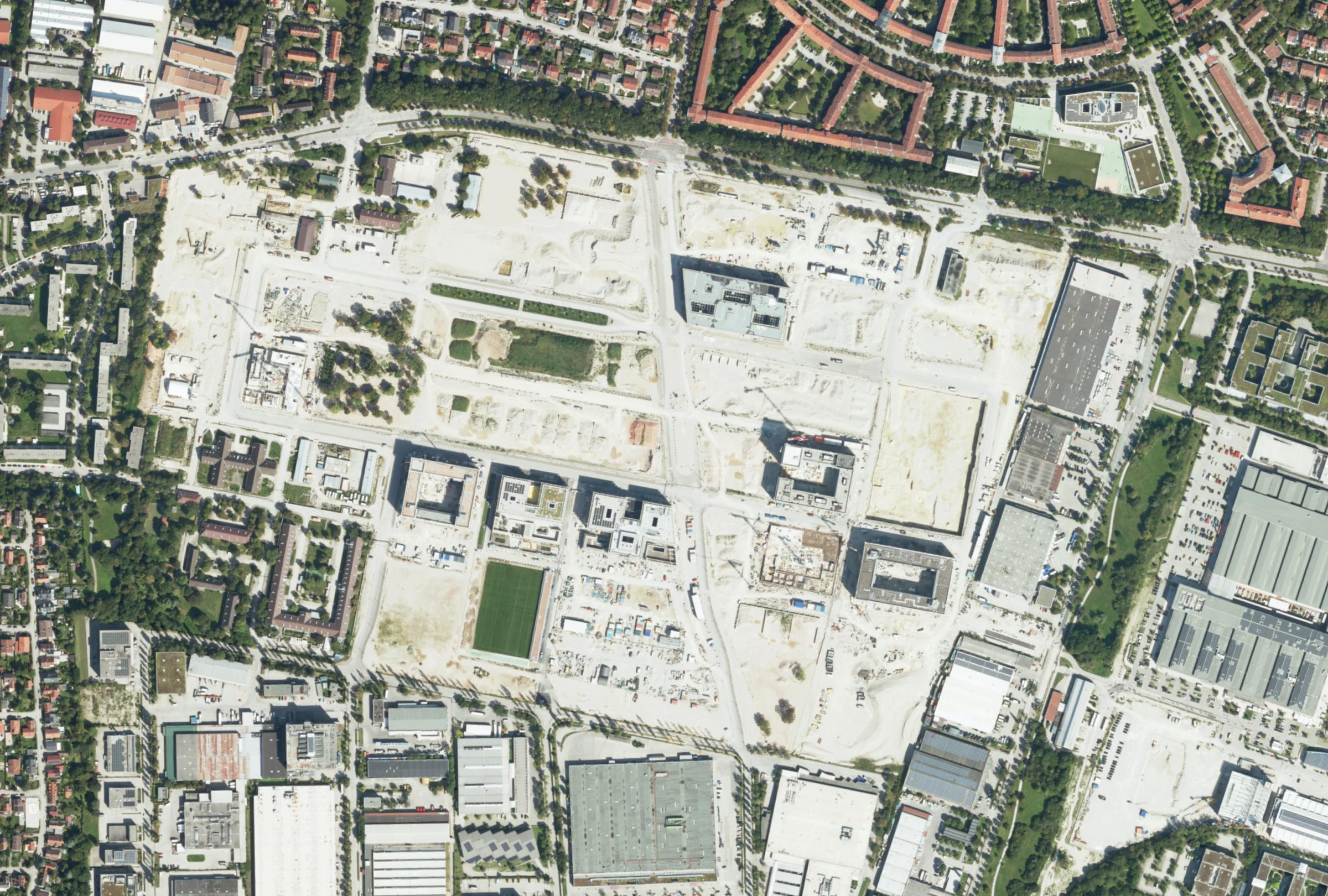 ↑ N≈ 200 m
Working area WGS84: 11.588–11.608° E / 48.194–48.203° N. DOP20 source resolution: 20 cm; the WMS crop was reprojected and resampled for display (approx. 62 cm per retained pixel). Source checks and spatial alignment support validation; this view does not present a validated analytical result.
This prepared case demonstrates the review record and its reasoning boundaries. Dated imagery provides source context; no validated AI classification result is presented in this view.
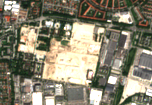
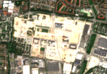
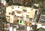
Contains modified Copernicus Sentinel data (2020, 2024, 2026). Earth Search / AWS Sentinel COGs.
Neufreimann source route: the retained Sentinel previews were obtained through Earth Search / AWS Sentinel COGs. The aerial image is from the Bavarian surveying authority.
District transformation is visible; completion of WA12 is not established by these images.
The 2020, 2024 and 2026 observations describe the wider district. The latest image predates the announcement by 10 days. These selected dates are historical context, not a monitoring frequency.
Start with a useful question
Inspect the public example, explore further cases in The Brief, or discuss the next decision about one property.
Explore case studies, based on real locations, historical imagery and geodata. See how CRI organises these sources for construction and collateral review.
Inspect the output format and reasoning boundaries in an existing public record.
View the public exampleExplore the records, a scoped reply and what human acceptance changes.
Request access to The BriefStart with one property, an earlier report and a current decision. Agree a first paid engagement with a documented Evidence Pack and next review step.
Discuss one propertyThe Brief is a private walkthrough of case studies based on real historical data. Access is free for invited visitors using a valid shared audience code or personal invitation. No email registration is needed for a shared code. New access requests are reviewed manually and do not grant access or create a pilot commitment.