 3BrainAI
Construction Risk Intelligence · the analytical principle
From satellite measurements to evidence for bank review.
What does the available evidence support about a financed site, and how does it relate to the reported project status? A useful bank review record brings together dated observations, relevant declarations, traceable sources and explicit uncertainty. Where the evidence is insufficient, it makes that limit clear and identifies where further verification is needed.
Read change across time and data sources.
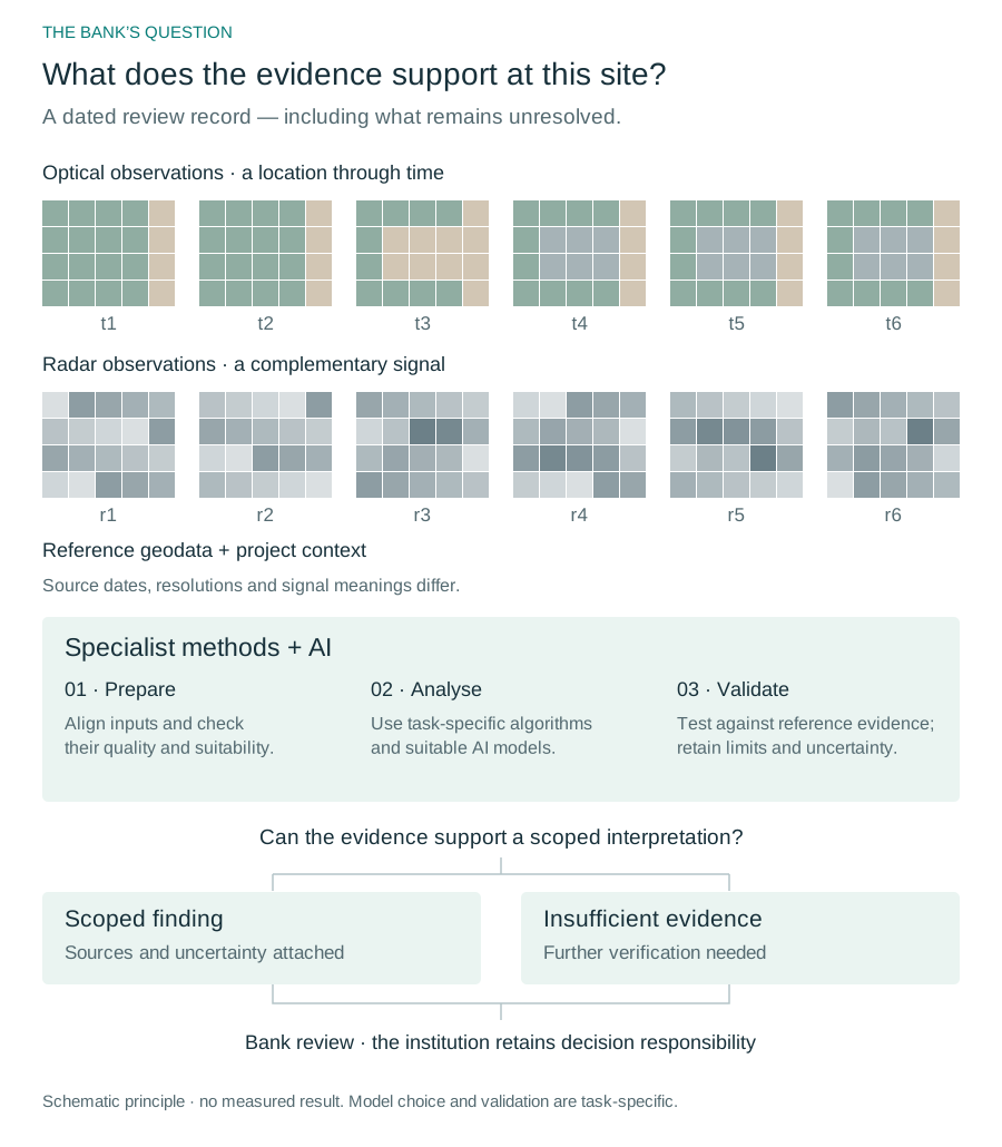
Optical and radar observations capture different properties of a location. Repeated measurements, relevant geospatial data and project context can reveal patterns that are not apparent in a single visual preview. Each source has a specific role and limits.
Apply AI where the task calls for it.
Preparing and aligning the data comes first. Specialist algorithms and suitable AI models can help identify patterns, classify relevant features and analyse change – for example, distinguishing a new structure from seasonal vegetation change in a time series. This is an example of an analytical task; whether it can be answered depends on the inputs, method and validation for the site.
The method must be tested against reference evidence for the intended task. An AI assistant may help construct a workflow; the analytical result still requires data processing and validation.
Bring the result back to the bank’s question.
The resulting evidence supports an institution’s assessment and identifies where further verification is needed. The institution retains its decision-making responsibility.
CRI currently has a guided prototype; a separate controlled-case demonstrator is under development. The public Evidence Pack illustrates the review record and its boundaries; the schematic above explains the analytical principle.
A data foundation for specialist work.
Copernicus data and the access and processing tools available through the Copernicus Data Space Ecosystem (CDSE) provide a foundation for this approach. Turning these resources into reliable, task-specific evidence requires appropriate methods, validation and domain knowledge.
Cloud computing and advances in machine learning expand what can be done with large satellite time series. The usefulness of a conclusion still depends on what the measurements support.
CDSE is a European data and processing ecosystem under ESA guidance, supporting Earth observation applications worldwide. 3BrainAI participates as a registered user.
Why can a useful input look coarse?
A visual preview shows only one representation of the measurements. Repeated observations and other data sources can add information about change and context. They do not guarantee that every small object can be identified or classified.
When is a local survey useful?
Aerial, drone or on-site observations can answer questions requiring local detail. Satellite time series add dated context across locations and periods. The bank’s question and the evidence required determine which sources are appropriate.